Investigation of municipal snow removal services and access to education in Syracuse
A Data Warriors project at Henninger High School
Keywords
Education Access, Snow Removal, Students, Syracuse
Overview
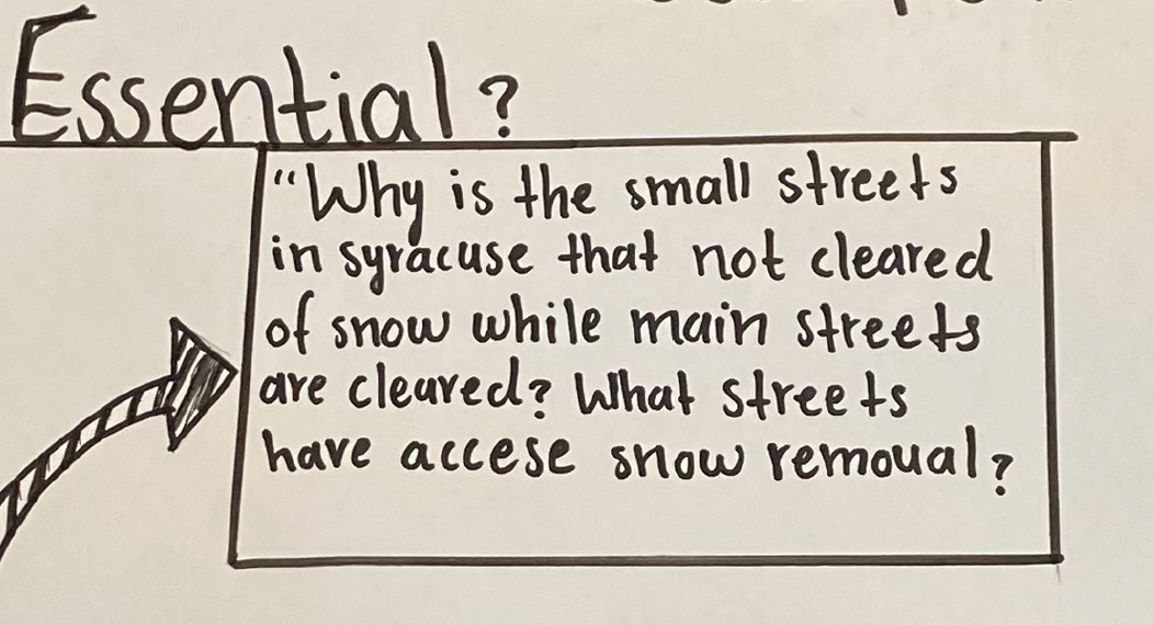
This project was developed by a group of students in the Data Warriors program at Henninger High School in Syracuse, New York. The group wanted to better understand whether students living on smaller residential streets and in different areas of Syracuse may face greater challenges getting to school in the winter than students who live on roads that are plowed more quickly. The core (or “burning”) research questions the group developed at the start of the project are in Figure 1.
Investigation of inequities around municipal snow removal services
Using publicly available data
To begin exploring these questions, the group used publicly available datasets from the City of Syracuse Open Data Portal along with U.S. Census data. These resources helped provide additional context for understanding how neighborhood conditions may shape winter transportation experiences for students.
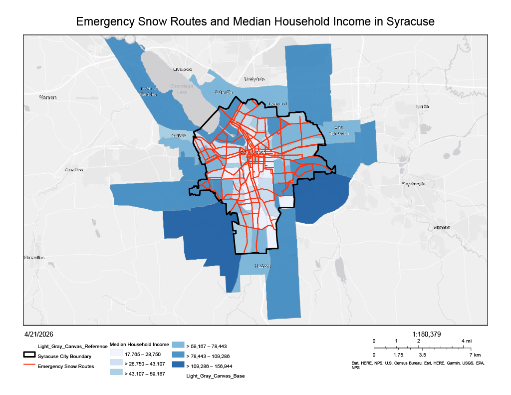
As one example, the group mapped median household income across Syracuse census tracts and compared these patterns with the city’s designated emergency snow routes in Figure 2. Emergency routes are typically prioritized for plowing during major snow events, which may influence how quickly roads become passable in different parts of the city.
Using collected survey data
To further investigate their questions, the group designed and conducted a survey for students at Henninger High School (n=36) focused on winter transportation experiences. Students shared data on their project through HydroShare, an open repository for sharing and discovering water-related data and research materials.
Information about the project is available here on HydroShare: Survey of Municipal Snow Removal Services and Access to Education in Syracuse. The survey responses themselves are not currently public; additional consent is needed before the raw data can be shared.
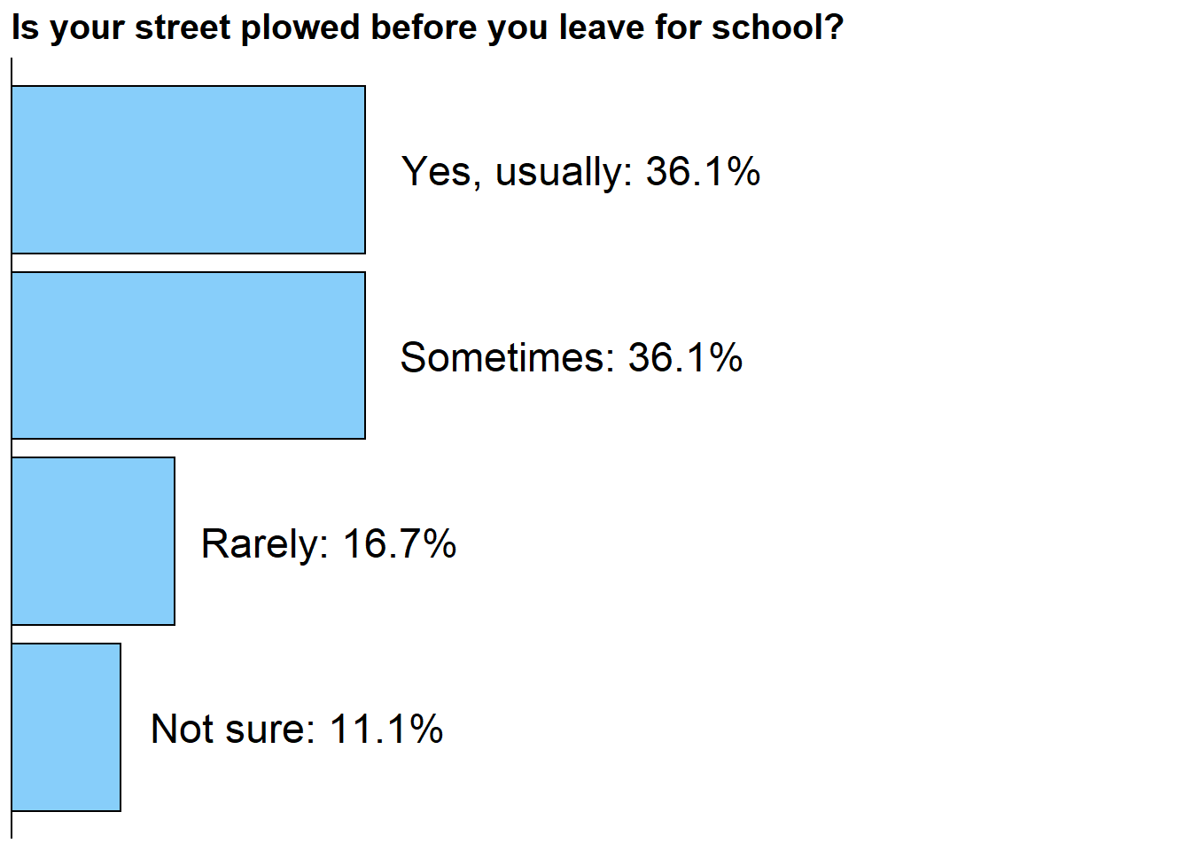
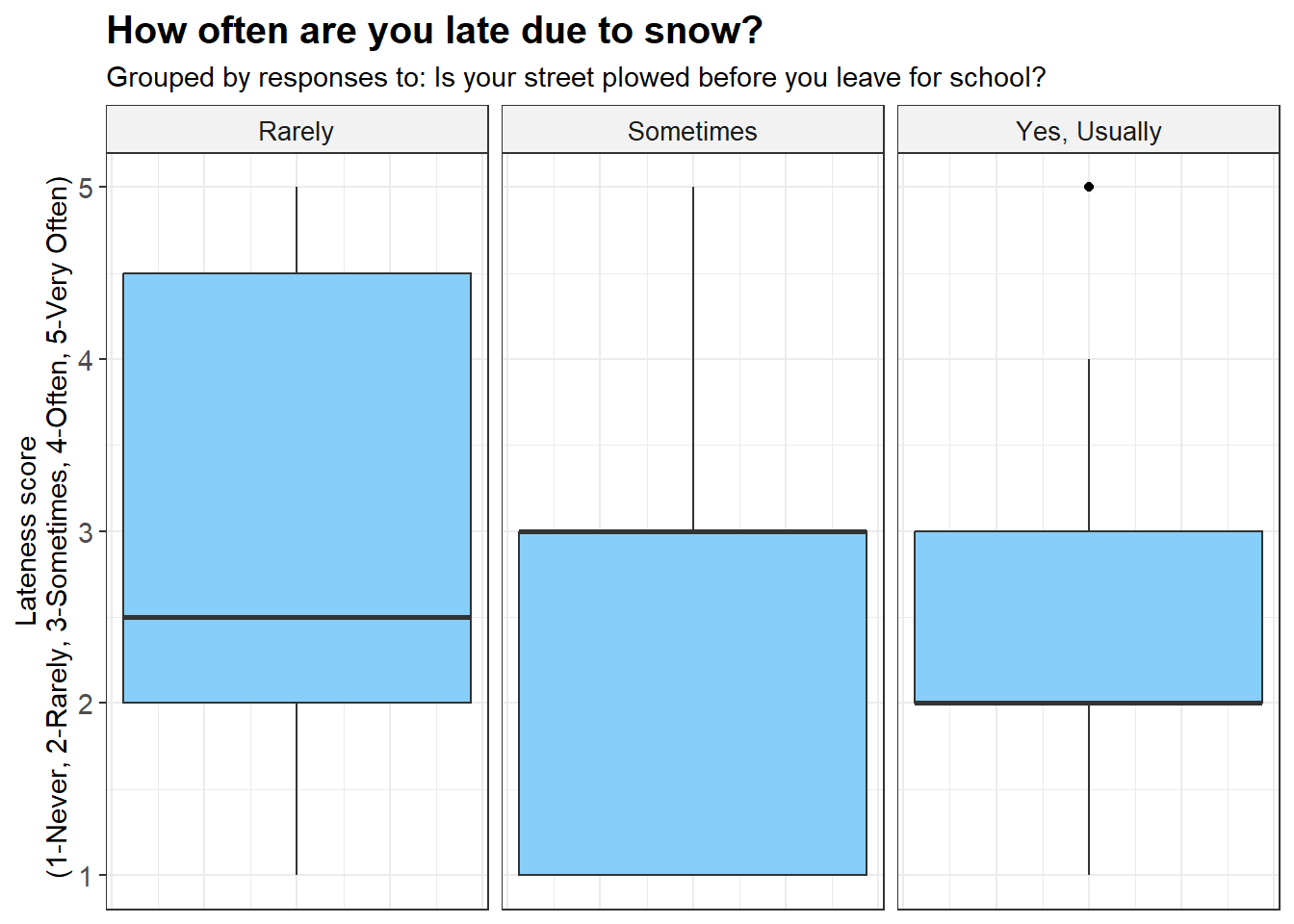
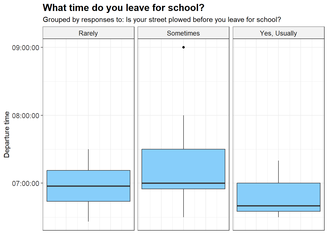
The plots in Figure 3, Figure 4, Figure 5, and Figure 6 below are generated from the students survey data.
Discussion
From the data collected by the group, less students than expected cited that their street was rarely plowed when they leave for school in the morning on snowy days. The survey responses suggest that students who live on streets that are plowed less often may be late more often to school, but this is not conclusive. It is recommended to give this survey to a larger cohort of stuents to better understand these relationships.
Furthermore, the group found that more detailed and publicly available information on how snow removal is prioritized across Syracuse could help support deeper research on potential inequities in access to education during winter months.
Call to Action
One key recommendation from the group is for the City of Syracuse to make more usable public data available on how snow plowing is prioritized across neighborhoods. While the city shares general information about plow operations, there is limited accessible data beyond the Emergency Snow Routes dataset.
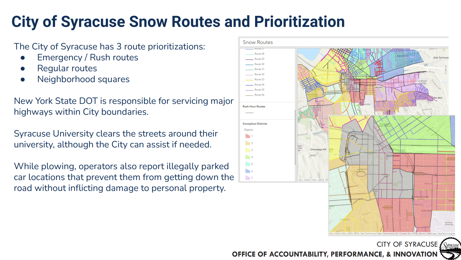
For example, the City of Syracuse Office of Accountability, Performance and Innovation explains how streets are prioritized during winter weather events in Figure 7, but this information is not available and usable on Open Data Syracuse.
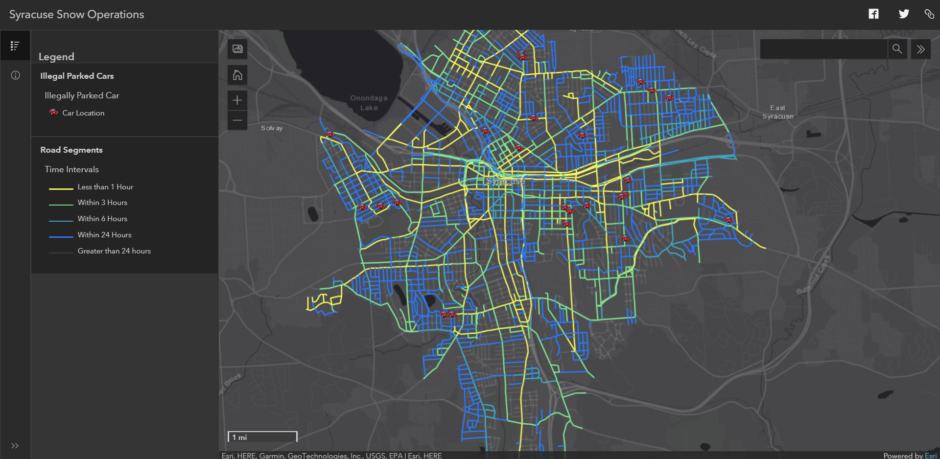
Futhermore, the city’s snow plow map shown in Figure 8 has improved public awareness around snow plowing in real time but does not currently provide historical data for deeper analysis.